My biggest backpacking dream at this point is a traverse of the Grand Canyon. This started out as just an idea, simply something fun to imagine. A full traverse of the Canyon is over 800 miles, most of it off trail, weaving in and out of side canyon after side canyon.
This first trip started as merely an attempt to get a taste of the full trip. My friend, Colin, has spent a lot of time in the Canyon. I asked him if he’d every consider a full traverse, which led to planning a partial traverse. Of course, after doing this trip I now want to try a full traverse.
This post will be about two partial traverses. The second trip is essentially just a piece of the first trip, but it’s in my favorite section of the Canyon and those photos are always worth sharing.
A few friends to know for these trips:
Colin- Expert geologist in all Earth things, Mars things, and other assorted outer space things.
Drew- Caught a Brown Trout in the Colorado (automatic expert fisherman status) and never misses a chance to hit you in the face with a snowball.
Tyler- Caught on camera in full disapproval mode and is “A FAIR WEATHER PERSON” only. Will usually play cards with you.
Brittany- My favorite. She’ll never hit you in the face with snowball, enjoys all kinds of weather, and offers whiskey if you’re cold.
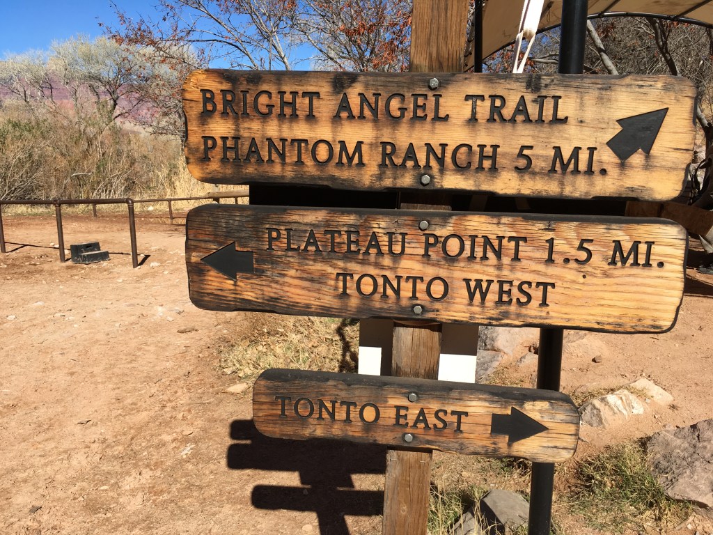
There are some trails that traverse east and west. The Beamer Trail takes hikers to the confluence of the Colorado and Little Colorado. The Escalante Route travels west from Tanner Beach through some of the most beautiful colors I’ve ever seen. From Red Canyon the Tonto Trail begins it’s methodical tour of side canyons all the way past South Bass Trail and to the end of the Royal Arch Route.
Tanner Trail to Confluence and Back to Boucher/ Hermit Trails– February 15-20, 2021
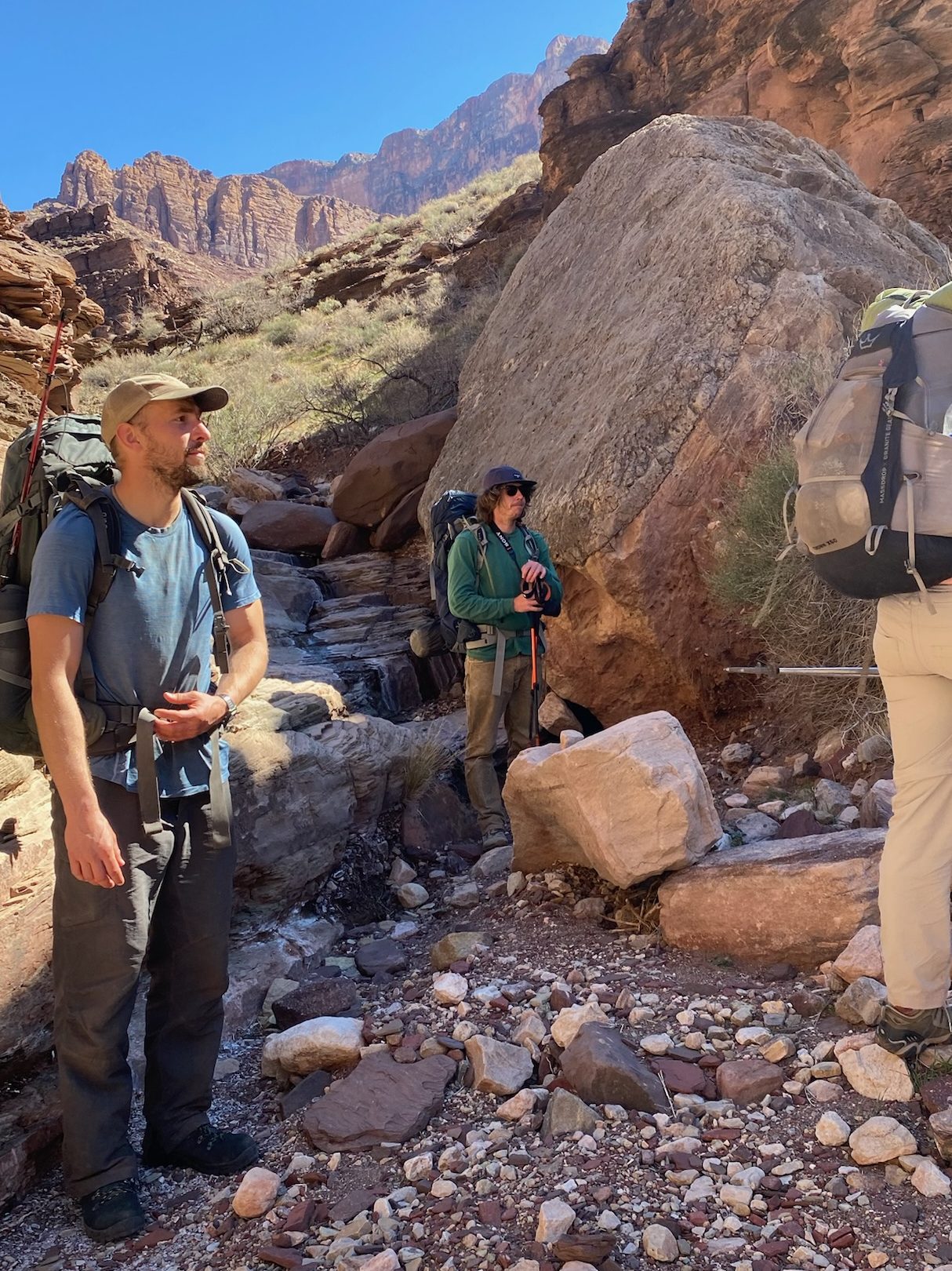
Colin and I planned a trip end of February using the Tanner, Beamer, Escalante, Tonto, and Boucher Trails, a total of 105 miles. The original plan was to hike the Tonto Trail all the way to the South Bass Trail, about an additional twenty-five miles. To arrive at this trailhead, the road partially travels through the Havasupai Reservation, which was closed at the time due to Covid. We considered leaving a vehicle before the reservation boundary and hiking cross country from the trailhead to avoid reservation land, which is about seven miles as the crow flies. We decided against it as this would make close to a twenty mile day on top of returning to Tanner Trailhead to pick up my vehicle.
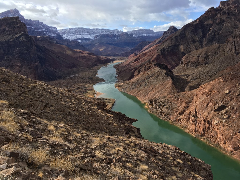
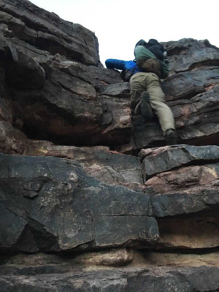
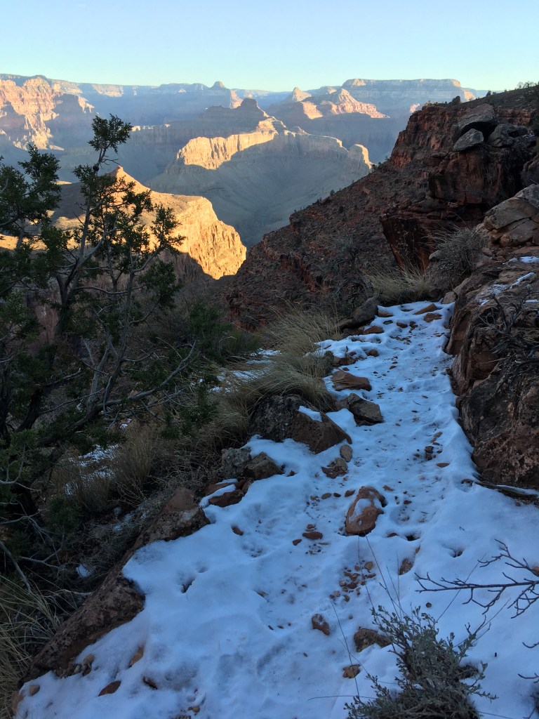
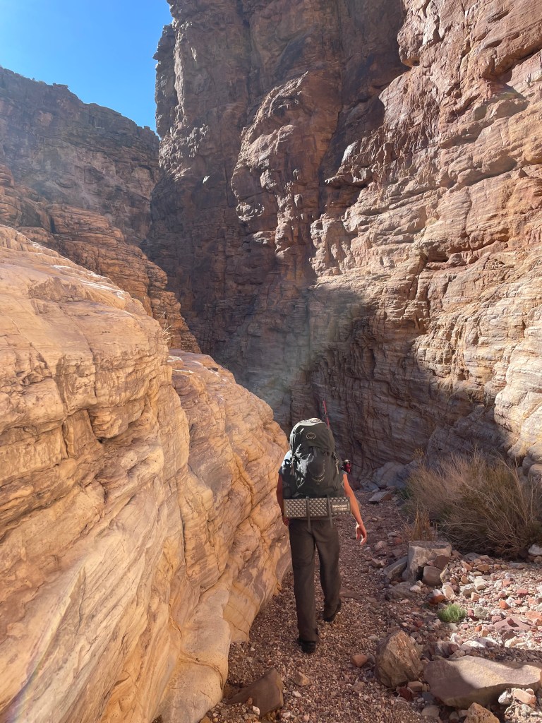
Our first morning we headed down Tanner Trail, about nine miles. From here the Beamer Trail heads east for about ten miles. Beamer is a good introduction prior to the Tonto Trail, as hikers tightly wind in and out of drainages. And it’s not a nice tour of drainages. Almost all of them include a steep, rocky thirty foot scrambles in and out.
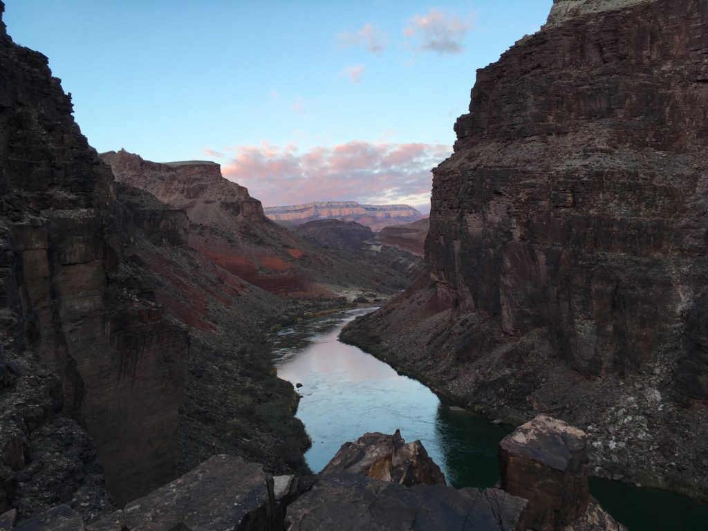
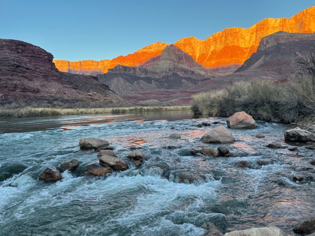
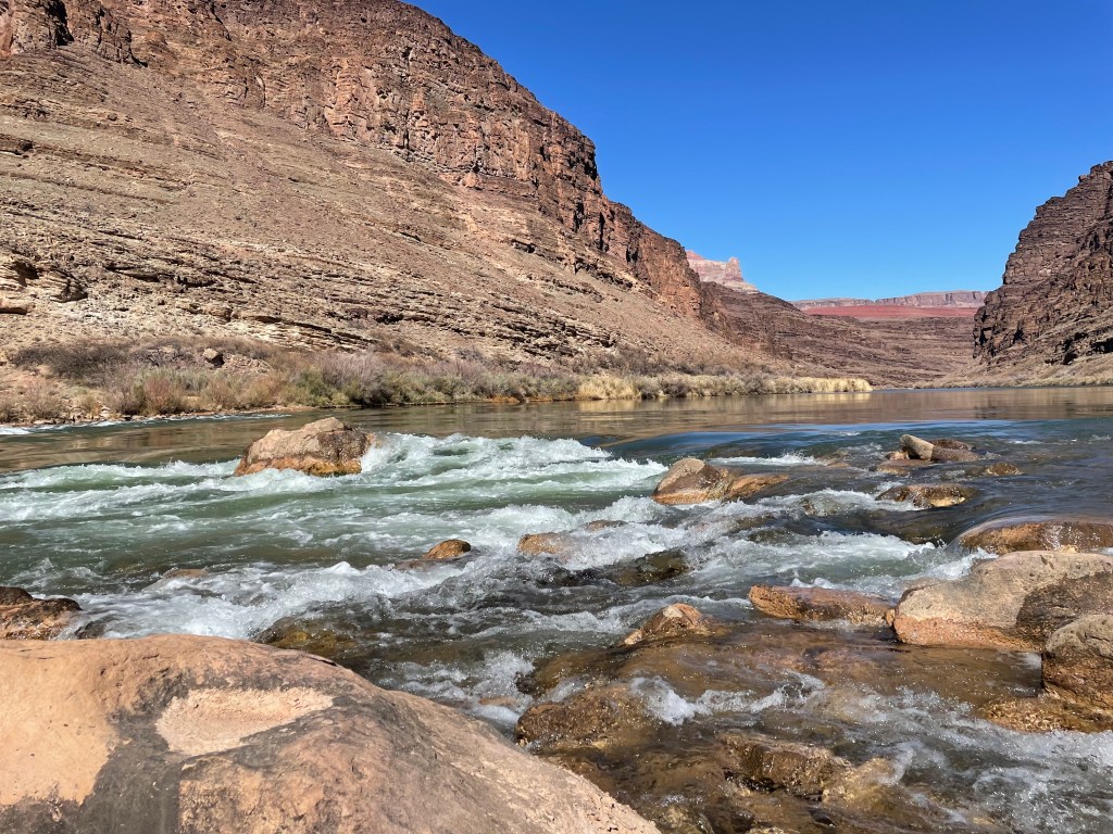
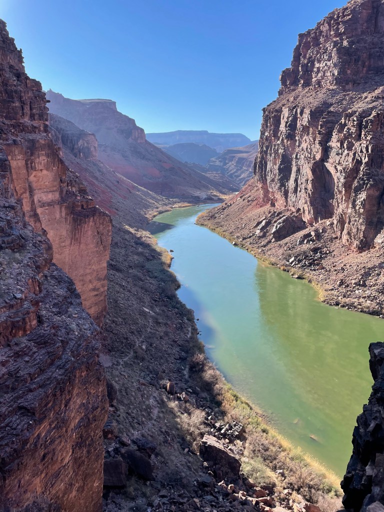
The Colorado River was emerald green and we could see golden sandbars just beneath the surface. A few pockets in the rock held residual rain water.
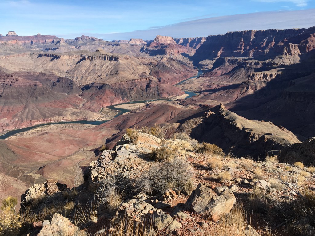

The confluence is probably, up to this point, the most beautiful thing I’ve even seen in the Canyon. It’s difficult to describe, but everything about it just looks perfect. Dark blue and light blue water mixes under red and tan rock. In the Little Colorado you can see algae rings that Colin tells me are pre-historic organisms (you’re going to have to ask him about them).
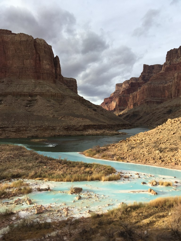

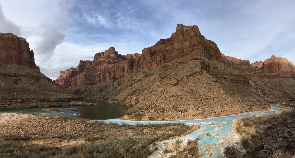
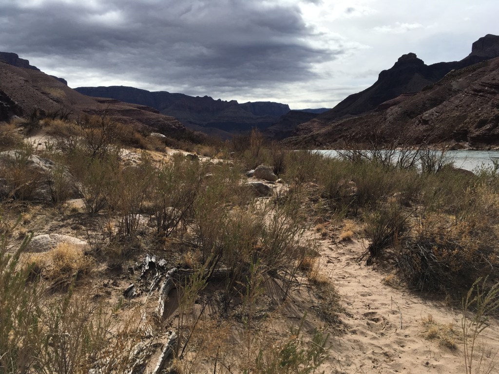
We camped about a half mile back up the Beamer Trail on a tiny beach since no camping is permitted at the confluence.
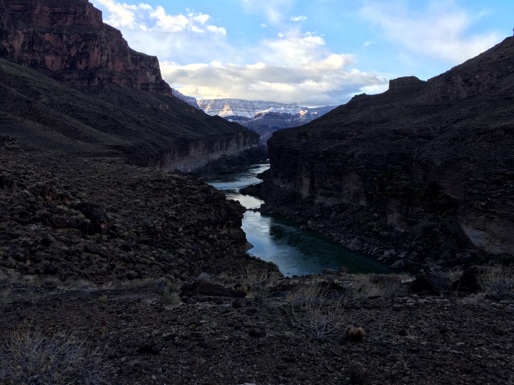
Night time rain in the canyon leads to stunning scenes the next day. Clouds were hanging low in the canyon and upper layers of rock had a fine dusting of snow.


We made it back to Tanner Beach around lunch time. It started hailing at lunch, but only for about twenty minutes.
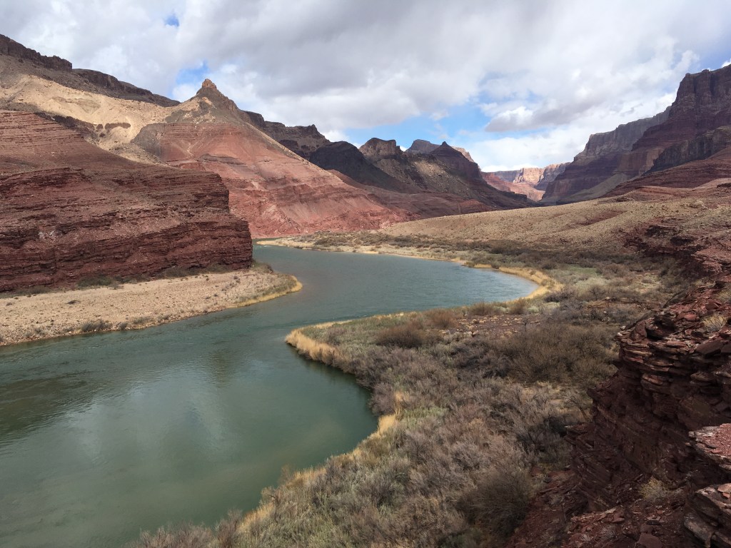
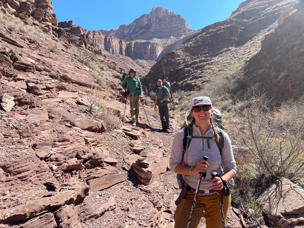
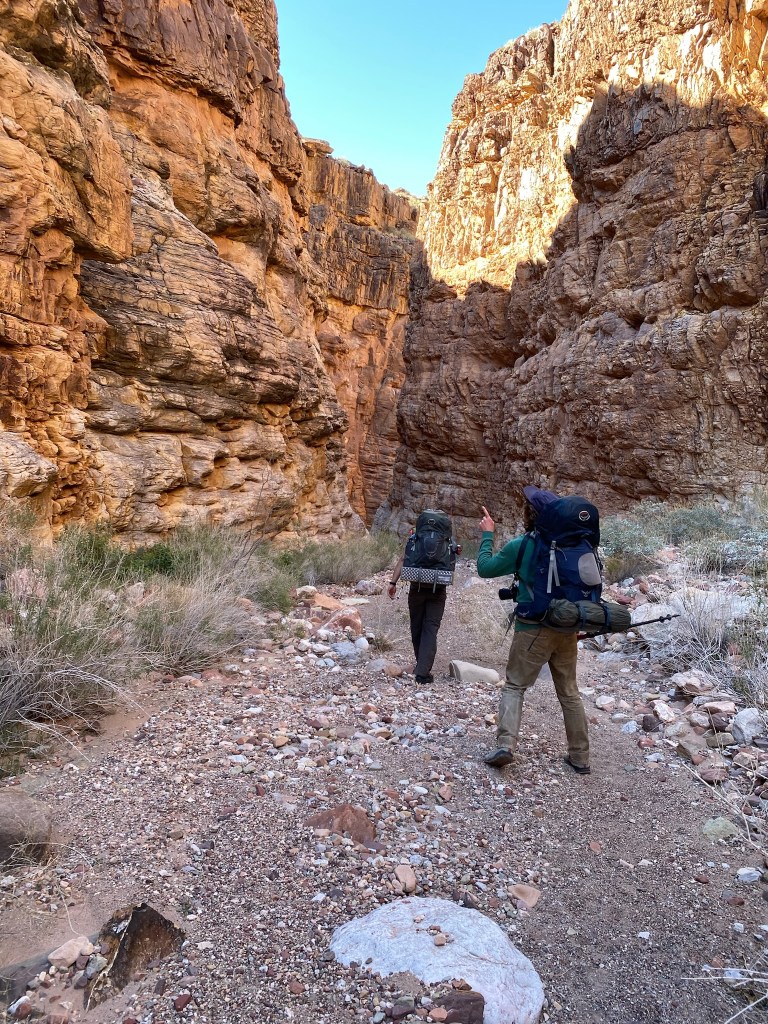
From here the Escalante Route heads west. Colin said about thirty years ago it was closer to a true route, but now it’s quite popular and basically a trail.
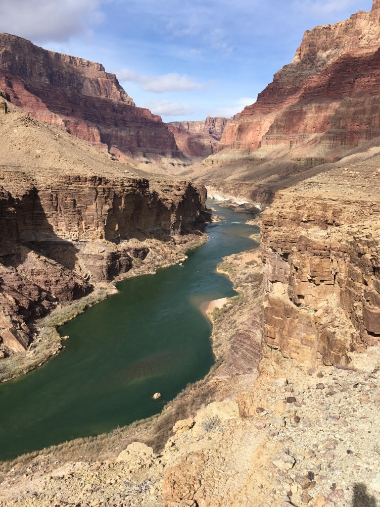
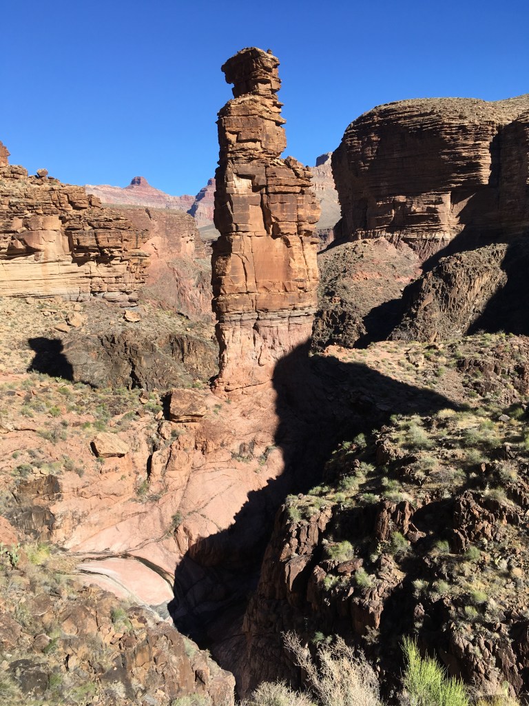
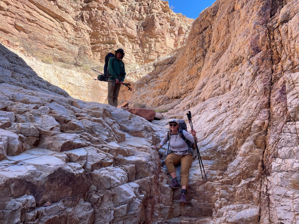
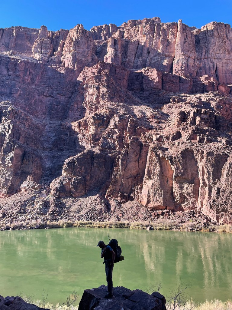
The Escalante Route is my favorite trail in the canyon. It starts out at river level and gradually starts to climb. Eventually hikers reach a point of quick, steep climbs and narrow trail. The trail builders knew the concept of switchbacks, but didn’t quite implement them as such. The trail follows 75-Mile Canyon back and then descends to the canyon bottom, winding it’s way back out to the rapids. From here the trail becomes a little more route like, getting rockier and disappearing in a few places. We camped for the night at a little beach right before the ledges.


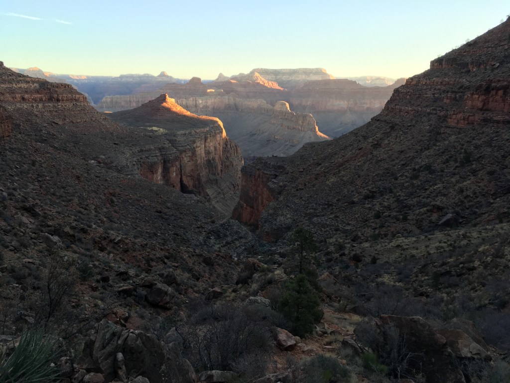
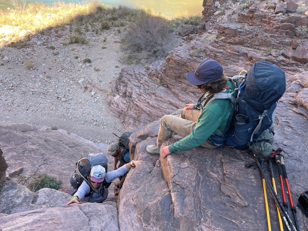
The ledges are about fifty feet tall and fairly easy to climb with good hand and foot holds. From the top hikers can see the mouth of Red Canyon. There’s a short rock slide to scramble down, but the path is reasonable. Once through the rock slide it’s about a mile along the river to arrive at the beach and Hance Rapids.

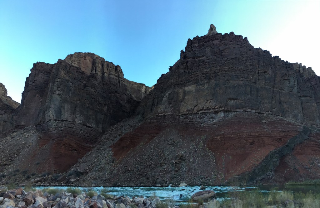
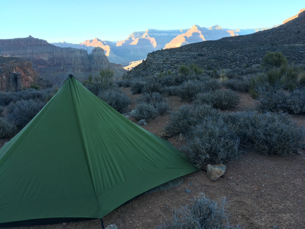
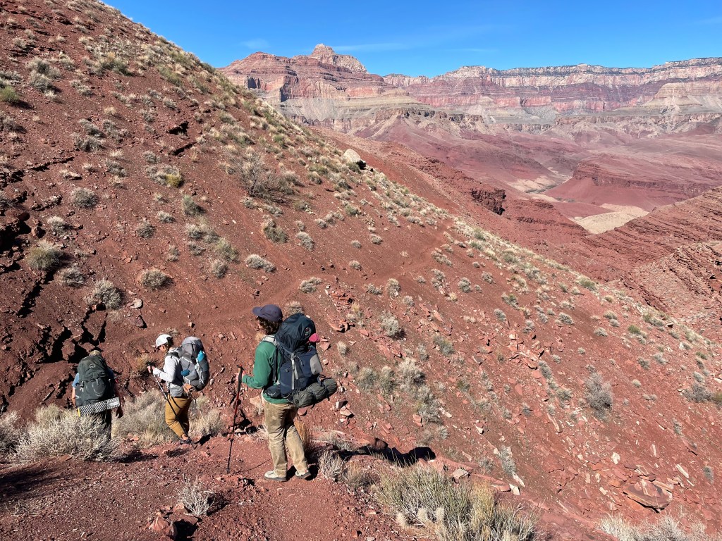
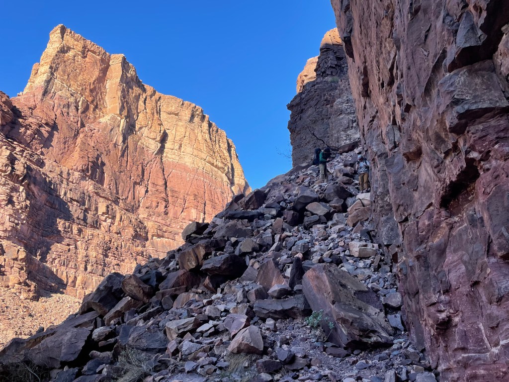
Hance Rapids is the start of the Tonto Trail and it’s ever winding through side canyons. There’s something to be said about approaching a side canyon, seeing the other side of it right in front of you, and knowing it’d take a couple hours to reach the other side. The biggest of these canyons is Grapevine. We decided anywhere else Grapevine Canyon warrants, at a minimum, national monument status. Our campsite for the night was nothing interesting, just the first flat spot we found in a small drainage.


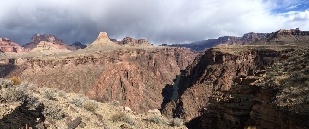
The next day took us through the Canyon’s main corridor. We only lost the Tonto once, but found it within a half hour. Luckily hiking on the mid-shelf level of the Canyon there’s not many places to go. We saw a few big horn sheep in the morning and passed through Cremation Canyon. The Tonto passes the South Kaibab Trail and the Tip off before traveling another four miles to intersect Bright Angel Trail and Indian Garden Campground.
After being fairly remote for three days, arriving at Indian Garden was overwhelming. We stopped for thirty minutes to grab water and within that time saw over twenty people and a helicopter.

From here the Tonto Trail is a popular backpacking loop for hikers entering the canyon on Hermit Trail. There’s several backcountry camps located on this stretch. We stayed our fourth night at Salt Creek Camp.
The next morning we passed by a few more backcountry camps including Monument Creek and Hermit Creek. We could see Granite and Hermit Rapids and just happened to catch a river trip floating by. The Tonto leaving Indian Garden is nicely groomed and maintained. The trail becomes much rougher leaving Hermit Creek Camp.


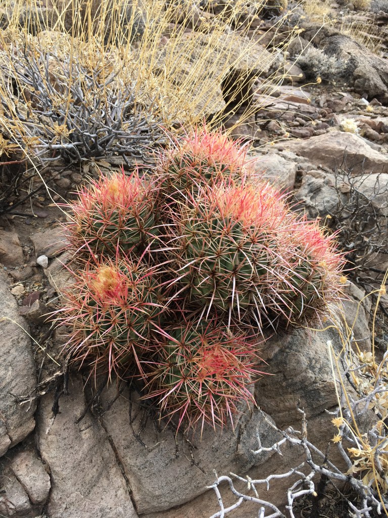
We planned to hike out Boucher Trail and connect over to Hermit Trail for our last day. We completed most of the Boucher climb and had one more spectacular view at camp. The Boucher Trail climbs up the opposite side of the side canyon that Hermit Trail travels. Temperatures were quite cool in the morning and there were a few small snow patches along the trail. One can also see the most stubborn plant alive, growing upside down out of a giant boulder. Boucher Trail passes the Dripping Springs trail junction and eventually intersects the Hermit Trail for the final climb to the top.


Eventually Colin and I have plans to finish the Tonto Trail and to hike South Bass. The goal is to incorporate the rest of the Tonto Trail into a trip with the Royal Arch Route. This would leave out South Bass for now, but who am I to complain about more trips into the canyon?
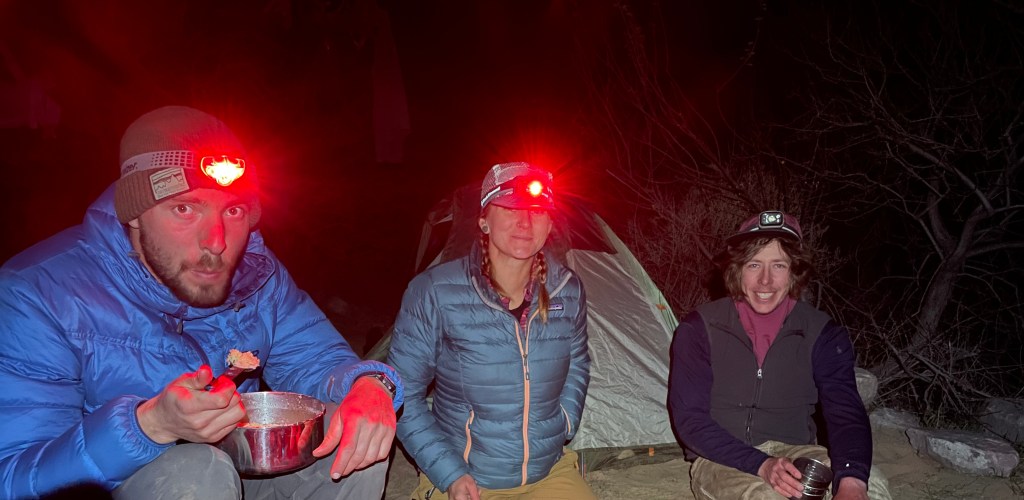
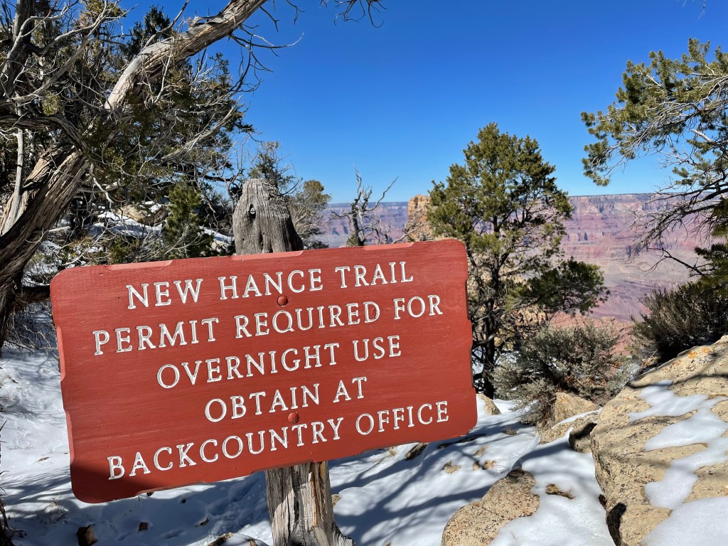
Tanner Trail, Escalante Route, New Hance Trail– February 24-26, 2022
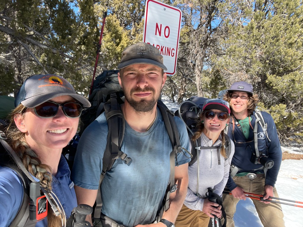
I work with Drew and Tyler all summer and got to work with Brittany for about a month the previous summer (I have friends outside work, I swear). All three are usually excited for all things Grand Canyon related.
Nothing was really new about this trip except hiking out on the New Hance Trail, so this section of the post is mostly just pictures worth sharing. I’ve also always wanted to camp at Tanner and Hance Beaches, which we got to do for this trip.
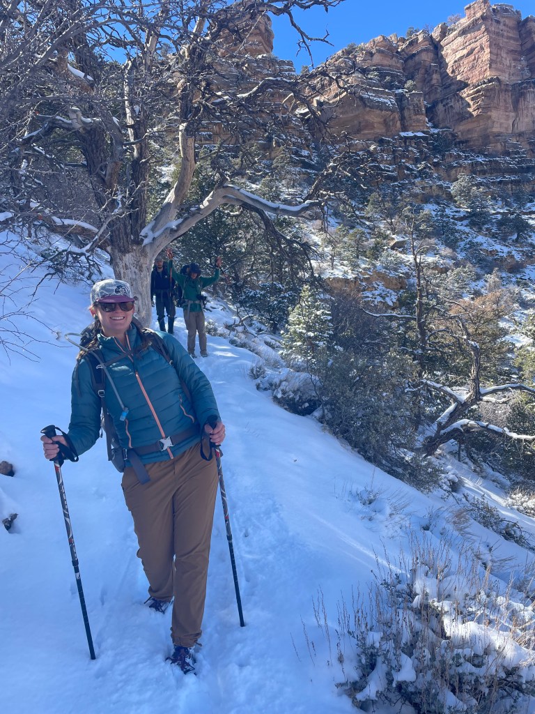
We switched our trip dates last minute to avoid hiking down Tanner Trail in a snow storm. The snow level, while reasonable, consisted of light fluffy snow, and a few slips occurred. Drew also hit me in the face with a snowball. I’m not bitter or anything.


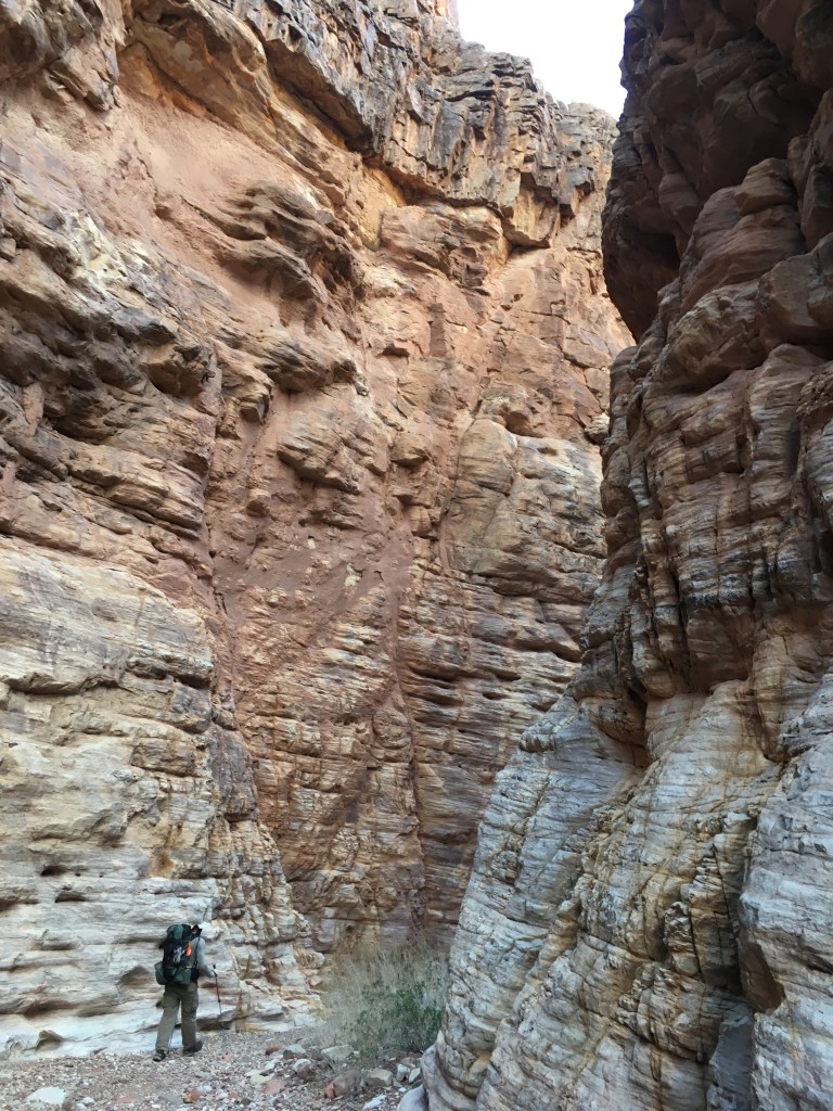
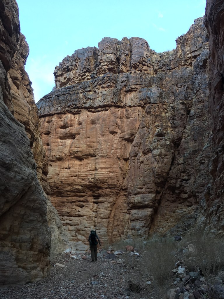
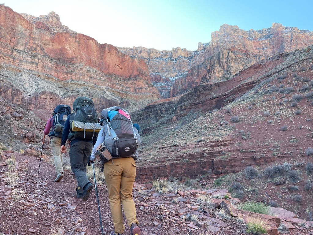
At first, New Hance Trail leaving the river and heading up Red Canyon is just the canyon bottom. There are a few scrambles to climb around giant boulders in some sections. A trail eventually does start part way up the canyon. Here we met two backpackers who traveled part way down the night before. They said everything about New Hance was reasonable in the snow and we’d have their footprints to follow, which was perfect. New Hance is known for being steep and faint in some areas and snow doesn’t help route finding.
New Hance, while only seven miles long, felt like the longest seven miles we’d ever hiked. The snow didn’t help our speed. It was also a very cold seven miles. We stopped for a short break part way up that left everyone freezing shortly after. Slowly, but surely, we wound our way through the snow and out of the canyon.


Drew and I have discussed attempting a full traverse of the Canyon in a few years. A few other trips need to occur prior though. We’re hoping to do a piece of the of the off-trail section this winter to see how it goes. We also need to try a few other routes (Colin has some ideas for us) to sharpen our off-trail skills. Until then you can be sure I’ll be planning some other trip to occupy my time!


