It’s nice to have a backpacking project and the Hayduke Route is definitely one of my favorite projects to date. After hiking 200+ miles of the route last year, I knew I had to keep picking away at the route this winter.
This time I decided to start at the beginning of the route in Arches National Park and travel south through part of Bears Ears National Monument to the Needles District of Canyonlands National Park, about ninety miles. I hadn’t visited both of these national parks since a family trip back in high school, so I was excited for another chance to see the area. I recruited a former hiking partner, Colin, who hiked part of the Arizona Trail and some trips in the Grand Canyon with me. We decided to start the trip November 16th and planned to hike for six days.
This trip required a shuttle set up the day before, on November 15th. My friend, Annette, kindly offered to meet us at Big Spring Overlook Trailhead in Canyonlands so I could drop off my truck and then she drove us to the start of the route in Arches.
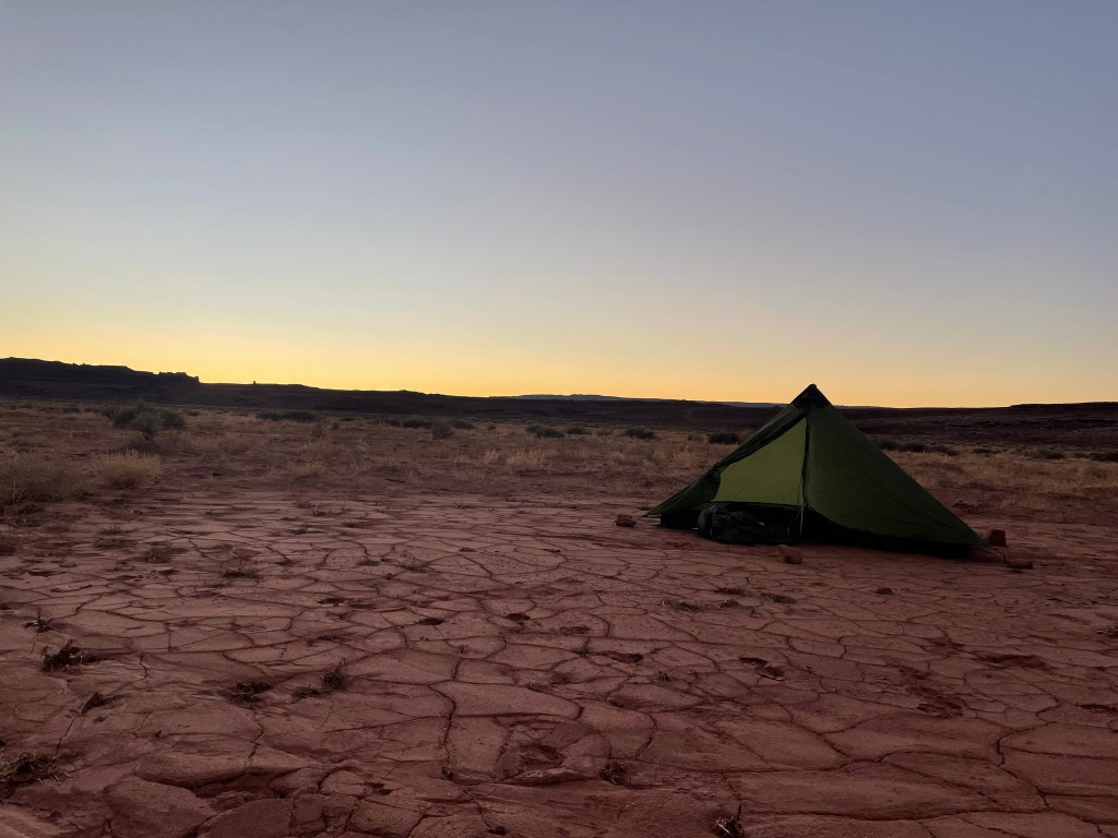
We camped outside the park fence boundary with the plan to start hiking the next morning.


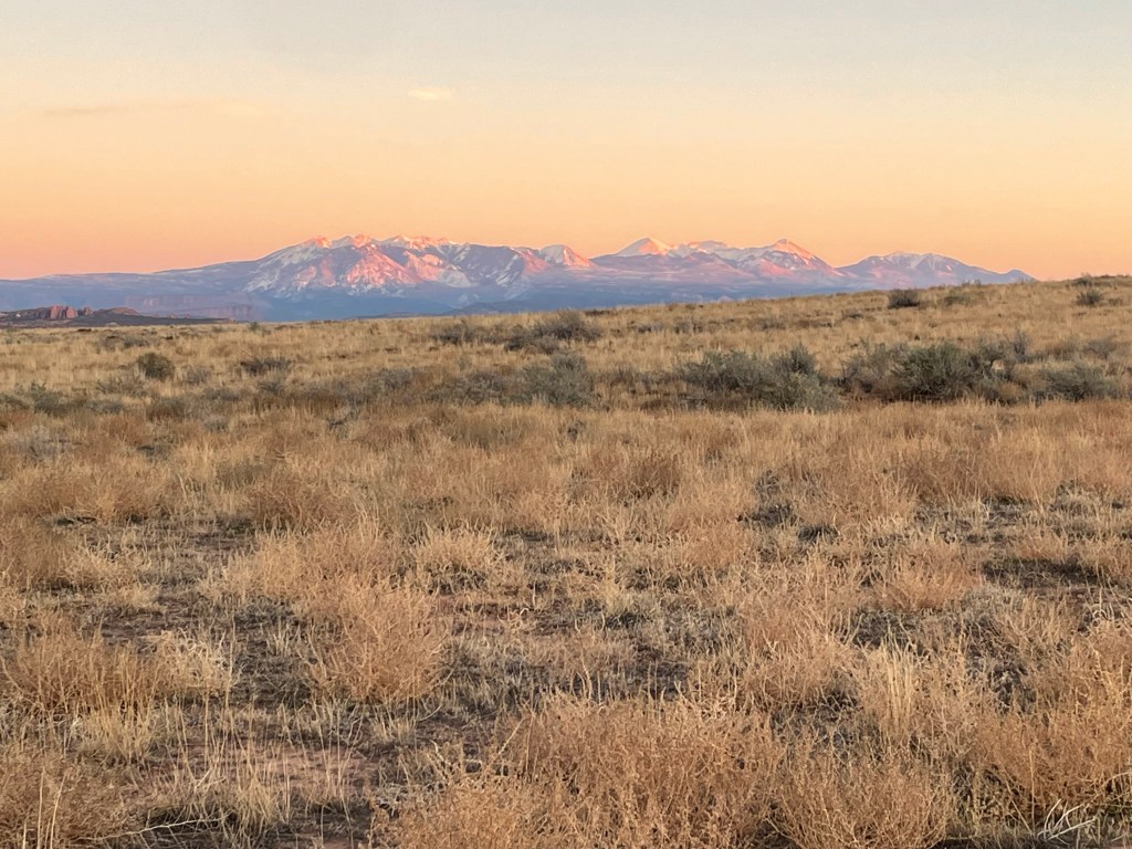
It was pretty chilly camping on night zero and that would set the tone of weather for the whole trip. We woke up at sunrise, but it took me a bit to feel warm enough to actually get out of my tent. Once, I finally packed up we had a quick five minute walk to enter Arches. The morning was overcast and in the distance the La Sal Mountains peaked out of the clouds.
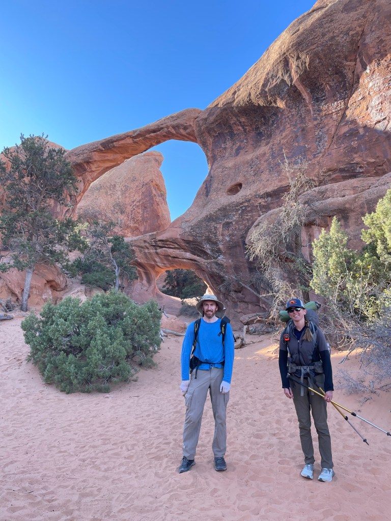
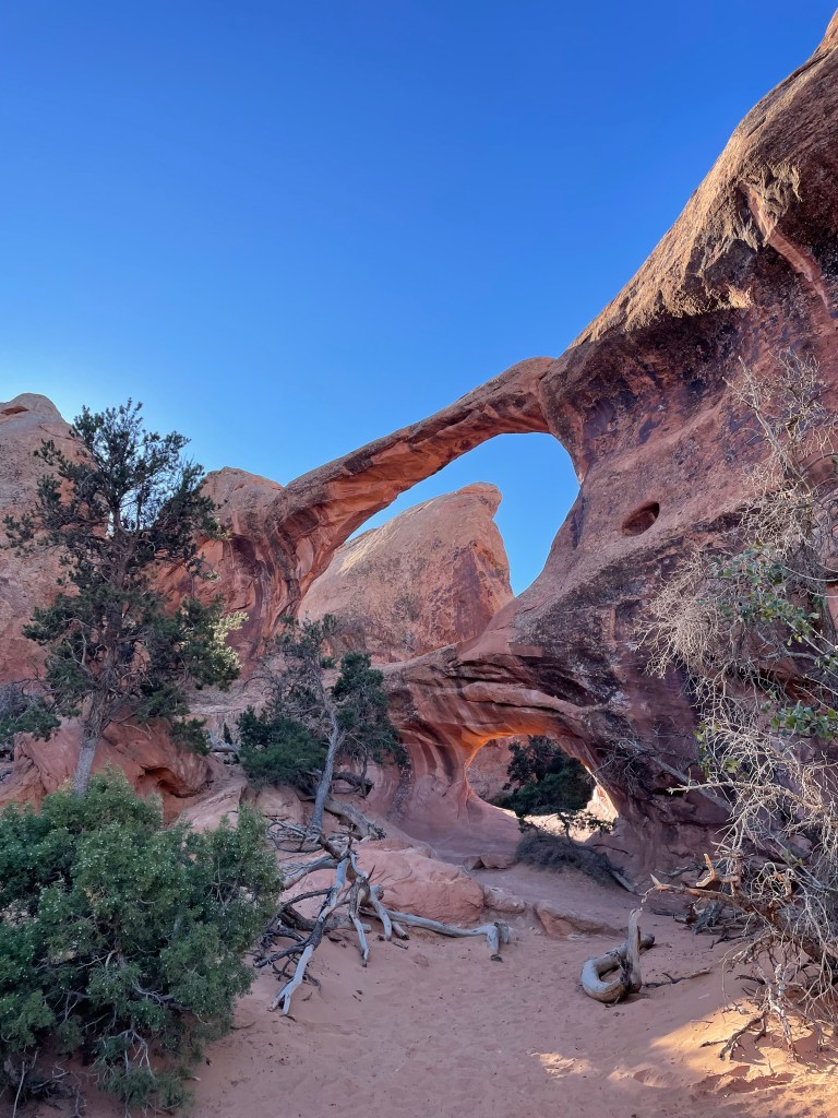
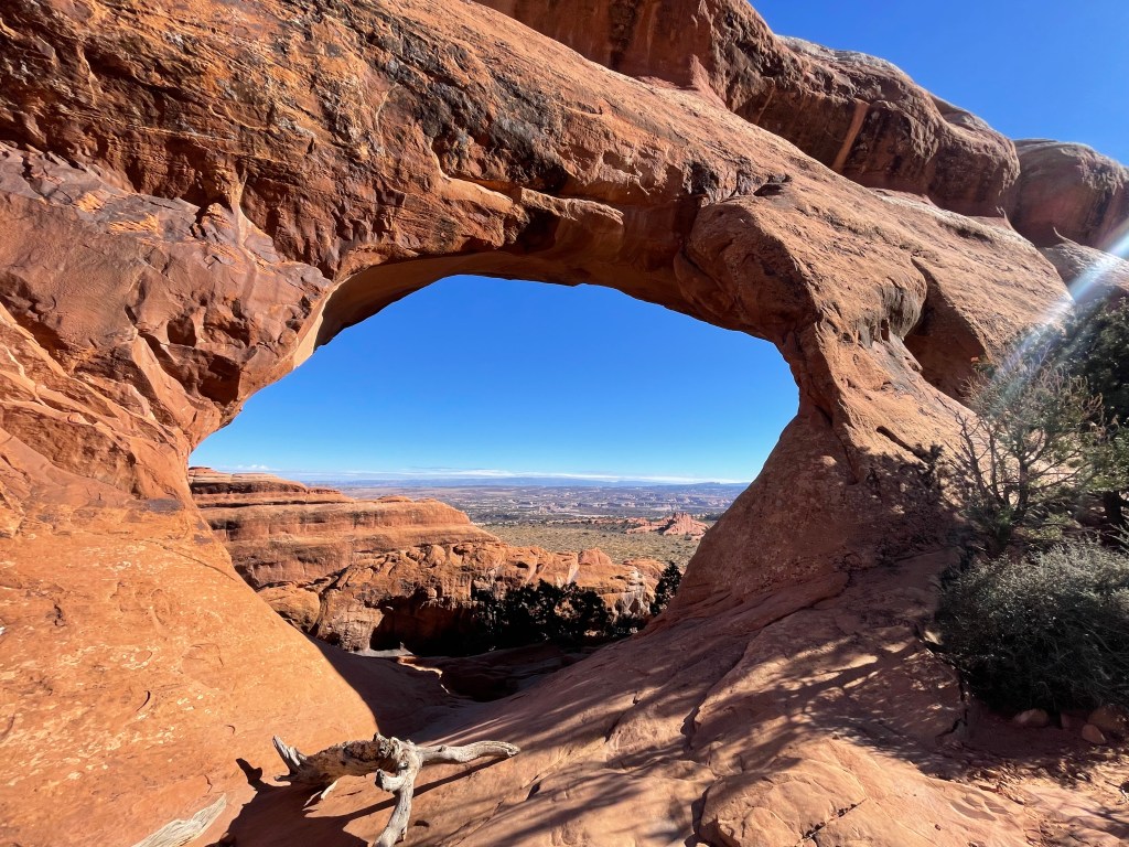
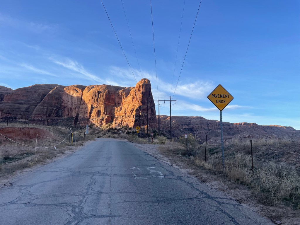
The Hayduke Route starts on Salt Valley Road, at the northern end of the park. The official route follows this road for several miles, but we decided to take an alternate about two miles down the road. This alternate takes hikers to Devil’s Garden Loop, passing some popular arches of the park. The official route doesn’t travel by many arches, so we decided we had to see some of the main attractions before heading back to the official trail.
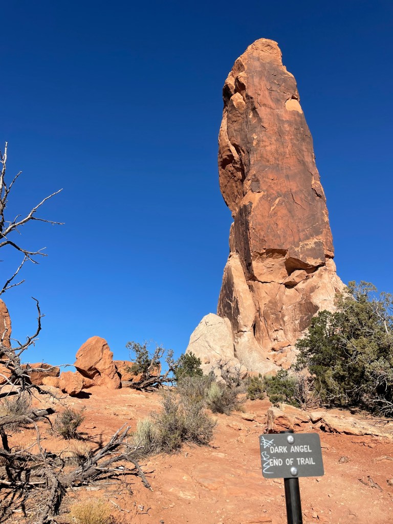
It was fun to put our route finding skills to the test right out of the gate. After a little deliberating, we picked a reasonable route to climb up to the Dark Angel rock formation to connect to Devil’s Garden Loop.

Once we made it up to a flat shelf it was a quick mile walk to reach the trail. The Dark Angel ends the trail, so from there we planned to hike to the trailhead and reconnect to the route from there. Some Hayduke hikers start at Devil’s Garden Loop Trailhead and then rejoin the Hayduke once they arrive at Dark Angel. The Hayduke is really a choose your own adventure type of trip.
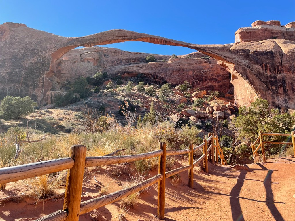
We saw several arches along the loop, including Double O Arch, Partition Arch, Navajo Arch, and the famous Landscape Arch. Despite the cold temperatures, a fair number of people were out enjoying the hiking loop.


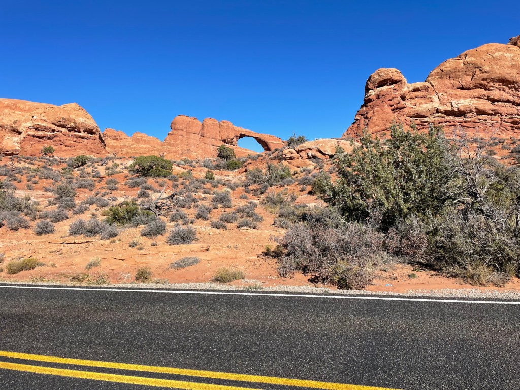
Once we reached the trailhead, we hike down the paved road for a couple miles, passing one more arch, Skyline, on the way. Eventually we turned back on to Salt Valley Road to start heading back toward the route. We followed pipeline markers downhill and then up a fairly significant hill to the park fence boundary. The official route continues south following the fence for a couple miles.

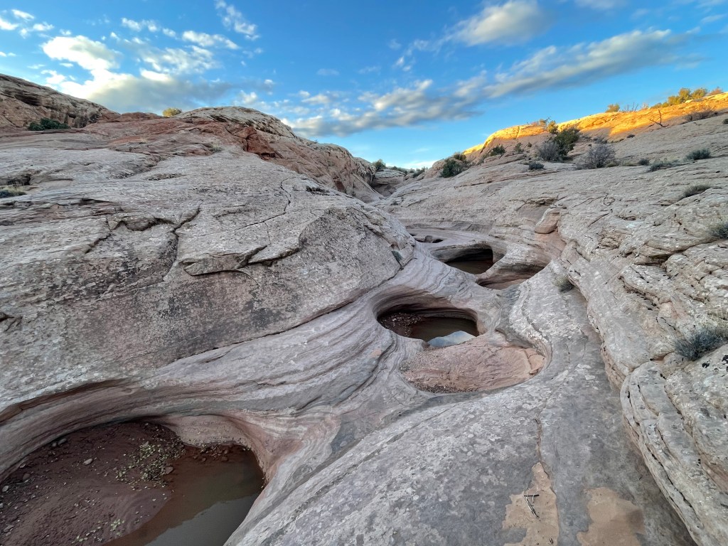
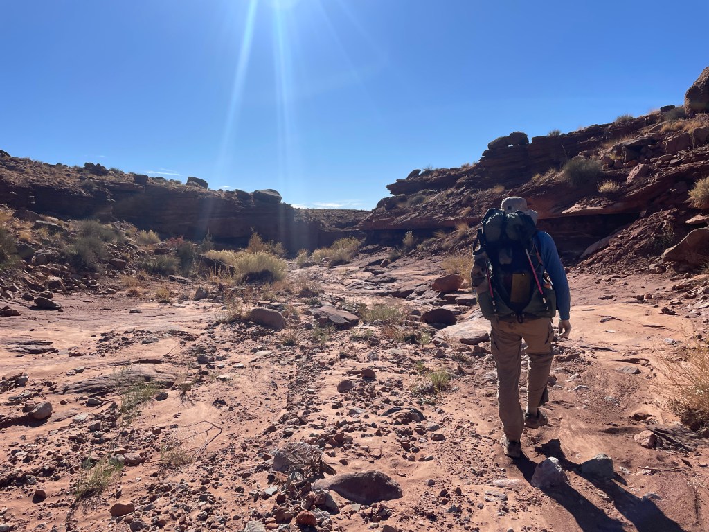
I didn’t realize that the fence angles south east, away from the direction we wanted to hike, but after a few minutes we figured out what drainage we were supposed to follow. Hiking in washes/canyons is the classic trademark of the Hayduke and this one didn’t disappoint. The wash started out as shallow slick rock with pools of water.
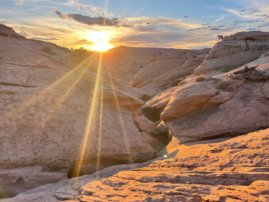
We crossed the park boundary again as the sun began to go down and set up camp. I didn’t have time to get permits for either park so we had to make sure we always camped outside of park boundaries.
The sunset was absolutely stunning that evening. Since we were on slick rock, I slept out for the night and it was chilly! I usually always try to sleep in a tent during the winter, whereas Colin will generally risk the no tent option (he did have a tent, just in case).
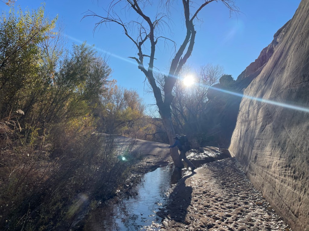
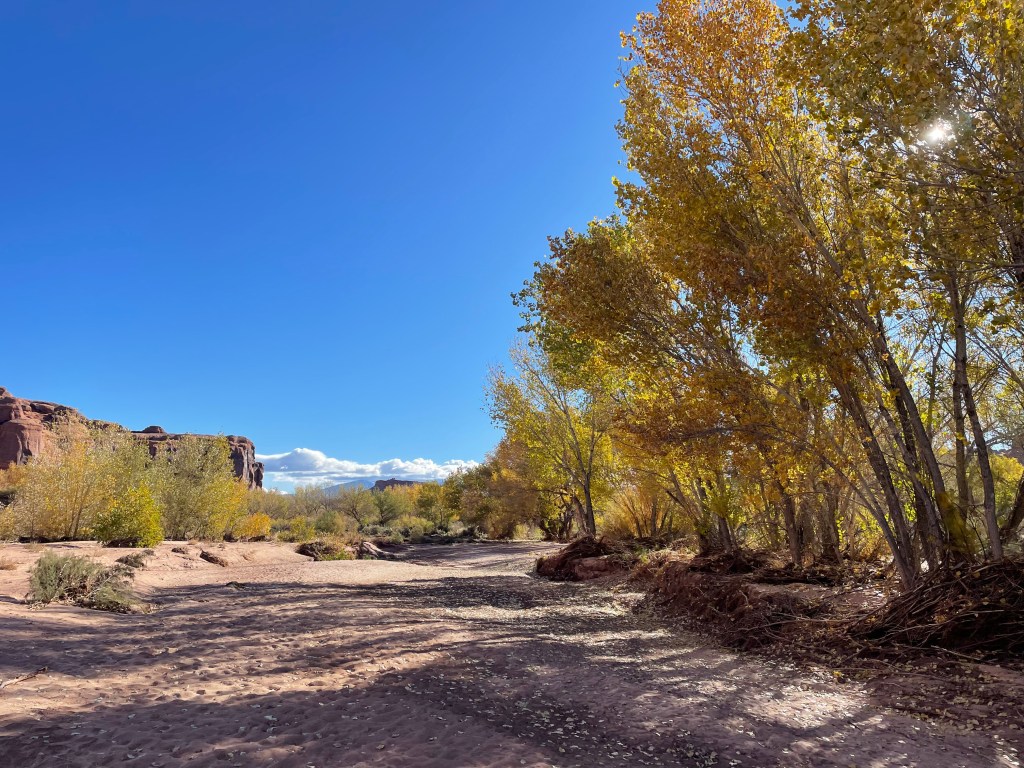
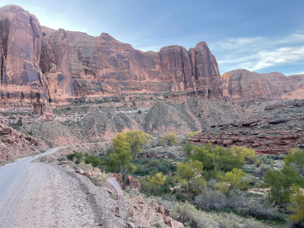
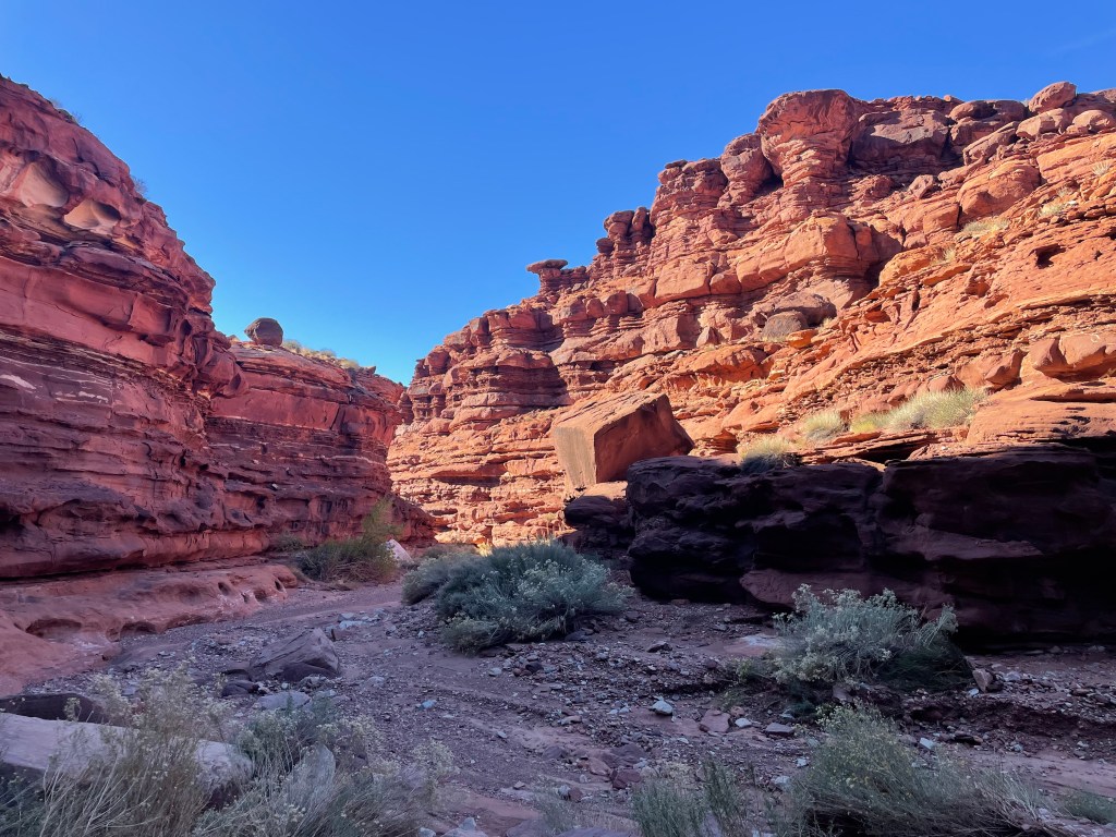
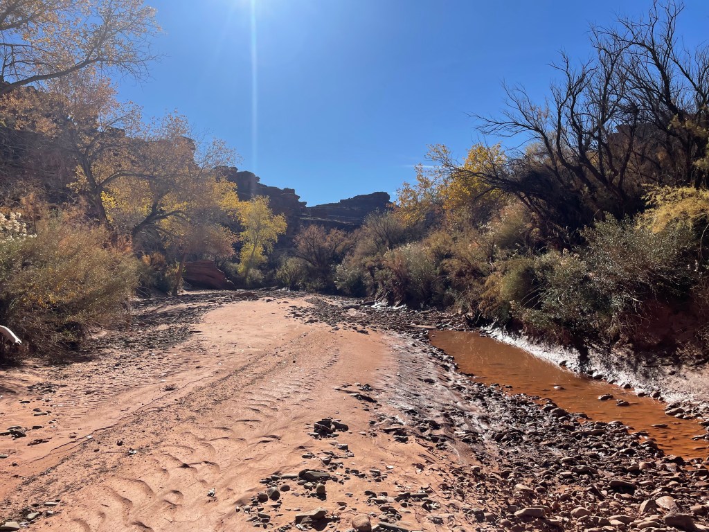
The next morning we continued down the drainage, which becomes Courthouse Wash. We had some large pools of water to navigate around, sometimes climbing out of the drainage and then dropping back down. It was good to see so much water in the wash and the trees had beautiful fall colors. We spent most of the morning crossing in and out of the creek. At one point we were taken aback, finding a beaver dam to navigate around and all the water it blocked.

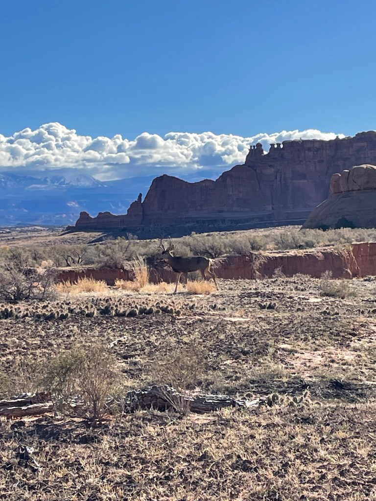
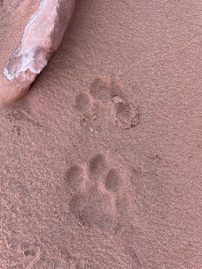
Courthouse Wash begins to widen as hikers approach the main park road. Large cracks run through the wash where water cut through soft soil leaving steep, crumbly dirt to try and scramble up. We knew we were getting close to the road due to all the shoe prints and loose dirt where people tried to climb out of the smaller washes. We saw one deer out for a morning stroll, the only wildlife we saw for the entire trip (cows do not count). Eventually we found a trail leading to the road.


Courthouse Wash continues past the road and narrows significantly again. We encountered even more water, that was deep, cold, and in some places ran right up to the sides of the wash. The afternoon consisted of one slightly questionable log crossing, one unfortunate wading attempt by me (the water came up to my hips), some tedious bushwhacking, and wet feet despite our best efforts.
Even with all the creek crossings, this part of the wash was beautiful! Water pooled and flowed over slick rock for most of the wash. The fall colors and canyon walls were reflected in shimmering pools and is probably one of my favorite parts about hiking in canyons.


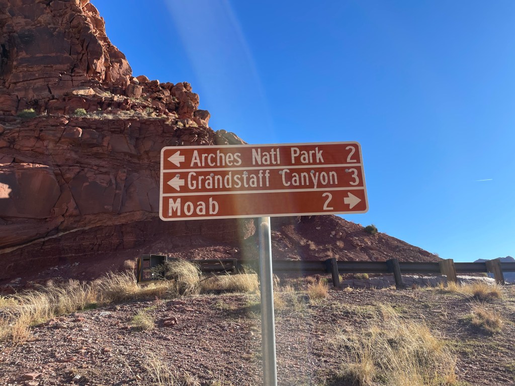
Despite the bushwhacking, we made pretty good time through the rest of Courthouse Wash. Later in the afternoon we crossed an Arches park boundary for the final time and started the walk into Moab. The bridge crossing the Colorado River made me laugh because you’d only find this sign in Moab.
Originally, my plan was to camp at King’s Bottom Campground. The closer we got to Moab, I came up with every reason to stay in town for the night. It was so cold the past two nights and with four more nights of camping, spending a night in town in a warm bed sounded pretty good. It was also supposed to be in the low twenties that night. Along with the opportunity for dinner not cooked in a pot, a beer, and a shower, it became hard to convince myself otherwise. Every other Hayduke hiker also stays in Moab, so why not go for the full experience.
Once in town, the route travels down S 500 W street before turning onto Kane Creek Boulevard. As we walked down the street toward the hotels, a guy came running across the street asking if we were on the Hayduke. We said we were hiking a couple sections and he introduced himself as one of the route creators, Mike Coronella. You know he purposely bought a house along the route to try and intercept as many hikers as possible traveling past. I would’ve loved to hear about all his other adventures; he must have many after creating a route like the Hayduke!

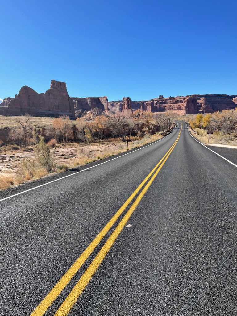
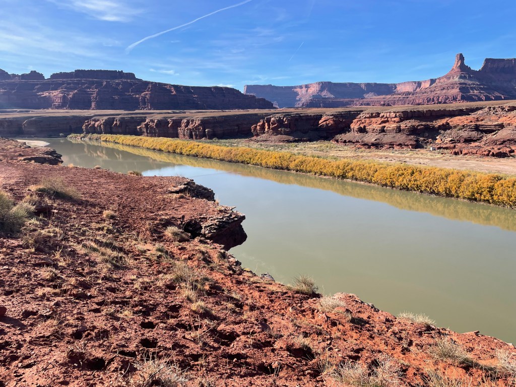
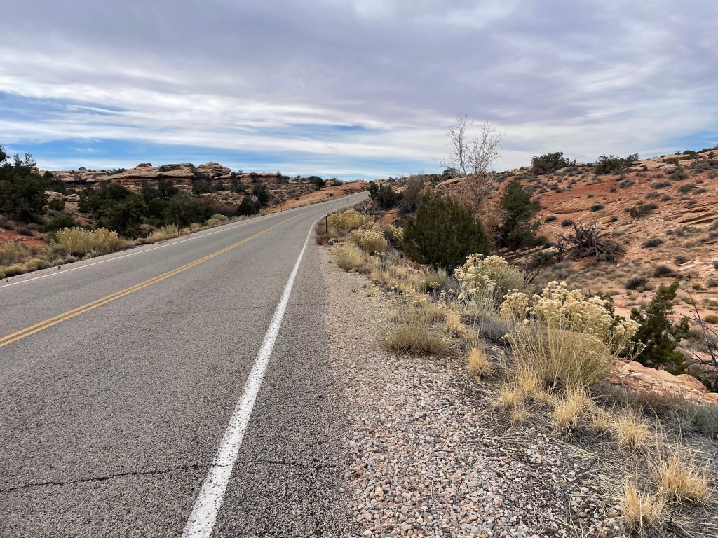
After sleeping warm, we started out early from the hotel a little after six in the morning. The day consisted of all road walking, so we hoped to get a lot of mileage done. Kane Springs Boulevard follows the Colorado River and is a popular road for recreationists. The morning was chilly waiting for the sun to finally shine on the canyon walls. After about ten miles of road walking, section one ends at the top of a climb up to Hurrah Pass. Section two starts out with about nineteen more miles of road walking.


As we hiked up to Hurrah Pass, a passing truck stopped to ask if we were hiking on the Hayduke. Tom owns Base Camp Adventure Lodge, about a half mile off the route, and told us we should stop by to fill up on water. The lodge, a cute little house sitting right on the Colorado, offers travelers water and food (we were offered grilled cheese sandwiches!), lodging in hogans, extra fuel for vehicles, and has a disc golf course.
They also play a big role in search and rescue in the area. Lockhart Basin Road and other roads in the area are popular four wheel drive routes for recreationists and several times a year the residents of the lodge assist people who get stuck on the rough roads. With this section of the Hayduke being very dry, the owner tries to catch all hikers passing through to make sure they top off on water at the lodge to avoid any more search and rescue incidents.


We left with about six liters of water from the lodge and intended to top off once more from the Colorado a few miles down the road. In hindsight, we should have just taken seven liters from the lodge and called it good. I found a path down to the Colorado, but there was some bushwhacking through tamarisk and some cows annoyed at their river spot being disturbed. After filtering my water, I threw some micro-pure tablets in as a precaution. At seven liters, this was our heaviest water carry of the trip (though not the worst water carry I’ve ever done). We had about twenty-five miles before we expected to find water again.
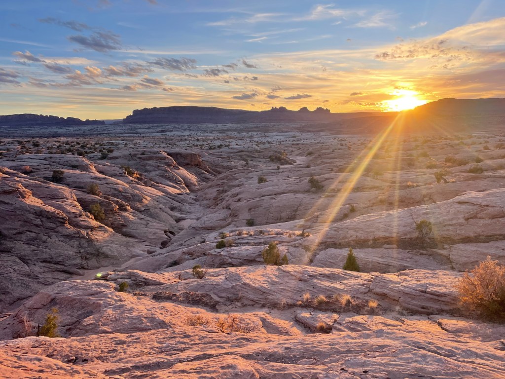
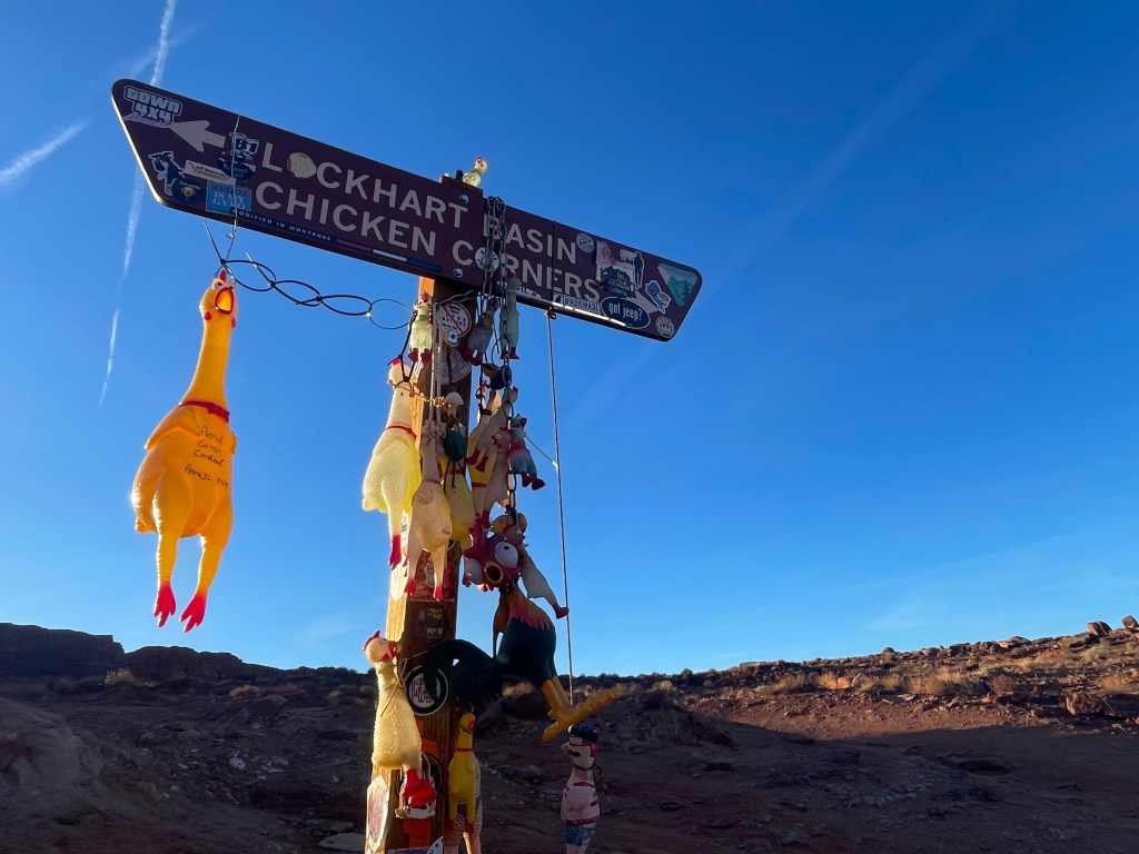
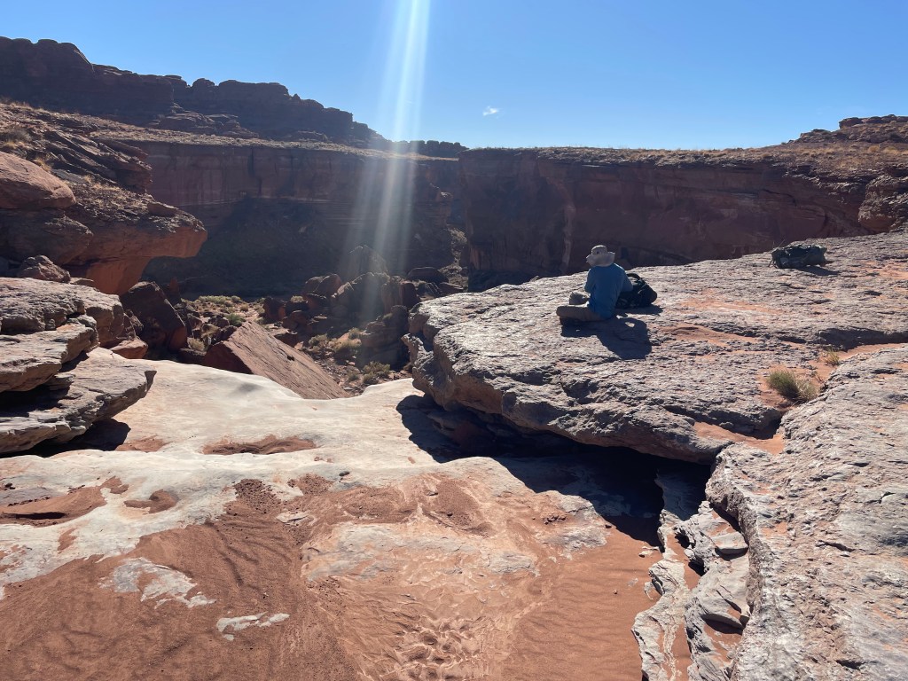
With about thirty minutes left in the day, we came across Lockhart Basin/ Chicken Corners road junction, decorated appropriately. The day ended hiking up to a shelf over looking the Colorado, just in time for the sunset.


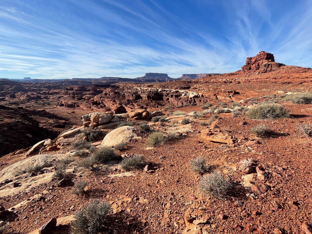
The next day had, you guessed it, even more road walking. Luckily we had a little route finding in the afternoon down a couple drainages. The route turns off the road and down a small canyon, taking hikers to a large pour-off. From the pour off, hikers turn onto a cow trail leading across a shelf to another drainage, marked by rocks in wire mesh. This drainage connects hikers back to the road (again…), now traveling through Lockhart Canyon. Traveling across the shelf we did our best to avoid crypto-biotic soil crusts. These soil crusts, little communities of organisms, take years to form and are vital to desert health in the southwest.
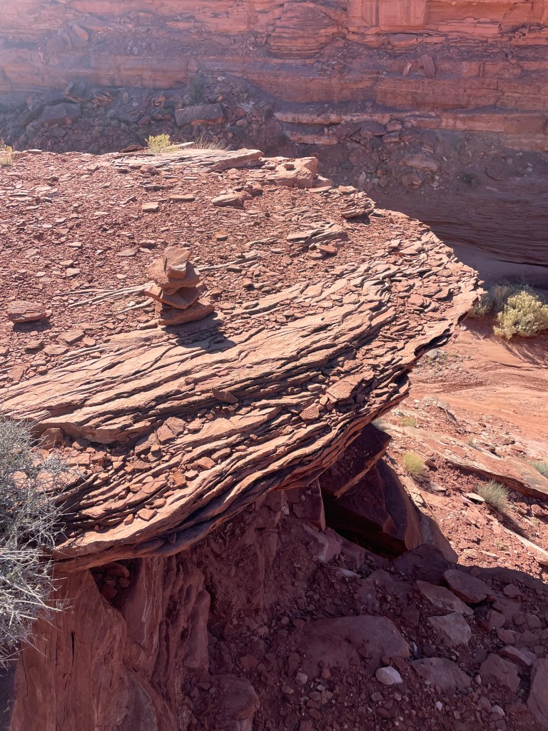
Even through the Hayduke is a route, signs of popularity pop up now and then, with rock cairns marking critical turns.

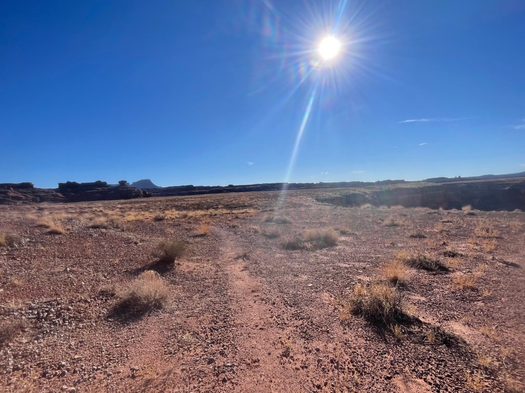
Luckily the road walking was coming to an end, with the majority of the next day consisting of route finding. We found a large, flat place to camp with cows roaming the surrounding fields. The past few nights were cold, but this night was even colder. I woke up in the morning with ice covering my tent.
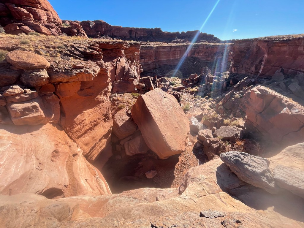
The upcoming part of the route is described in the guidebook as “no man’s land” and lives up to the description. After a few more miles on the road, we briefly traveled cross country to a drainage to enter Rustler Canyon. We knew of one upcoming large pour-off to navigate down and encountered one smaller surprise pour-off. The large pour-off was easy enough to scramble down with passing packs.

A few miles down Rustler Canyon, we turned south into Indian Creek. There were pools to collect water from and a lot of mud. I was slipping and sliding all over the place.
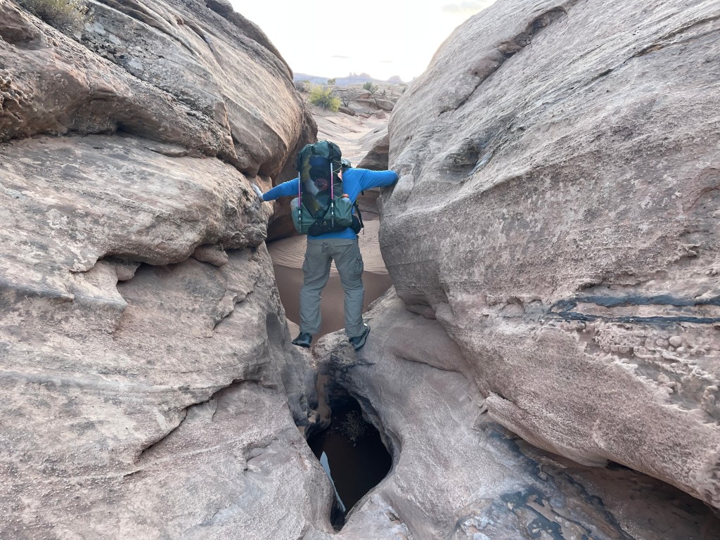
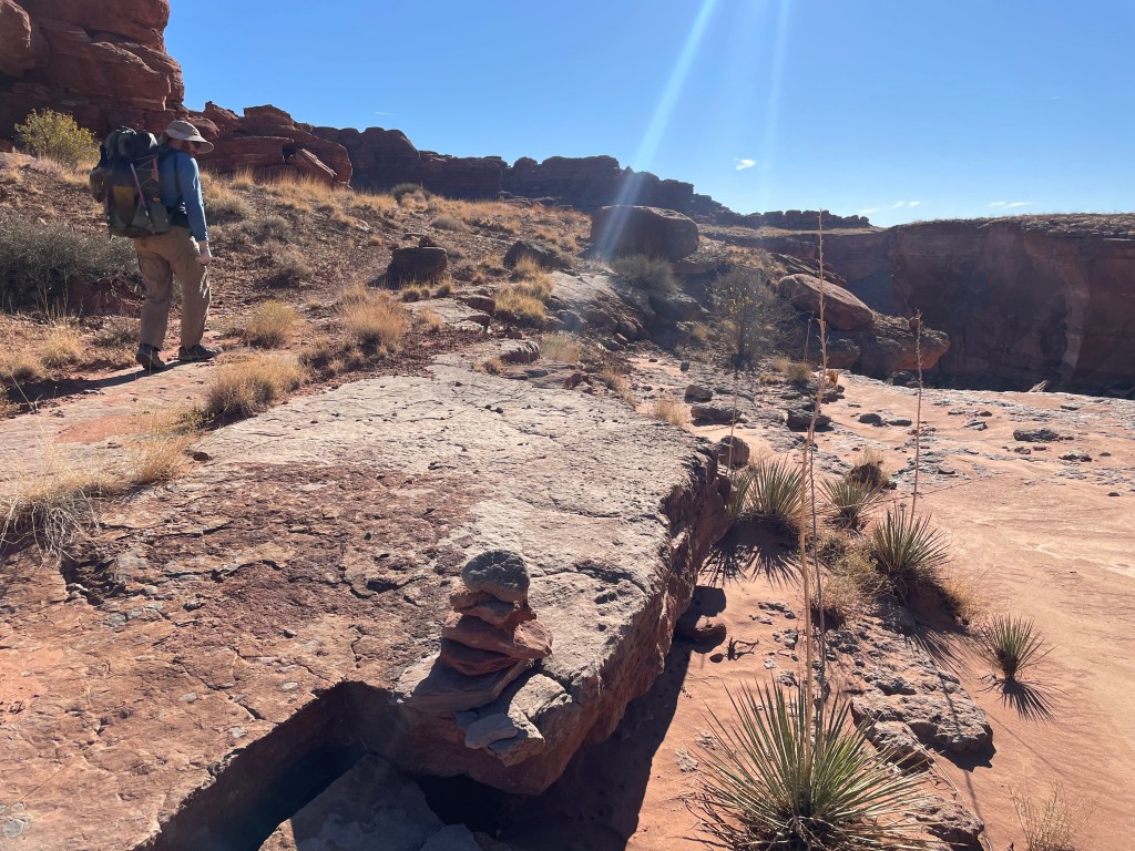
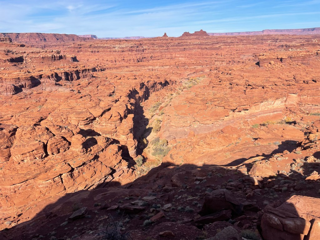
Indian Creek turns sharply to the east, marking another important way point in the route. From here we started to scramble out of the canyon and working our way through rock ledges. A couple cairns marked the way up an easy drainage, but from there we were on our own. We found multiple sets of footprints wandering off in different directions and we had one more layer of ledges to climb up. After a little investigating and discussion, we found an area of rock that seemed climbable if we handed packs up.

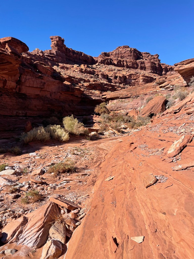


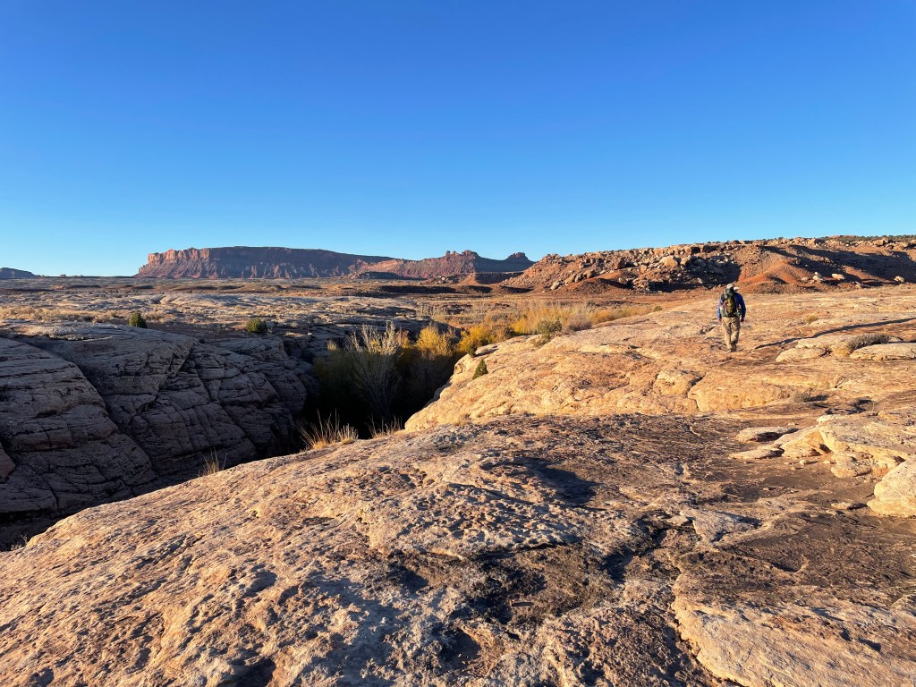
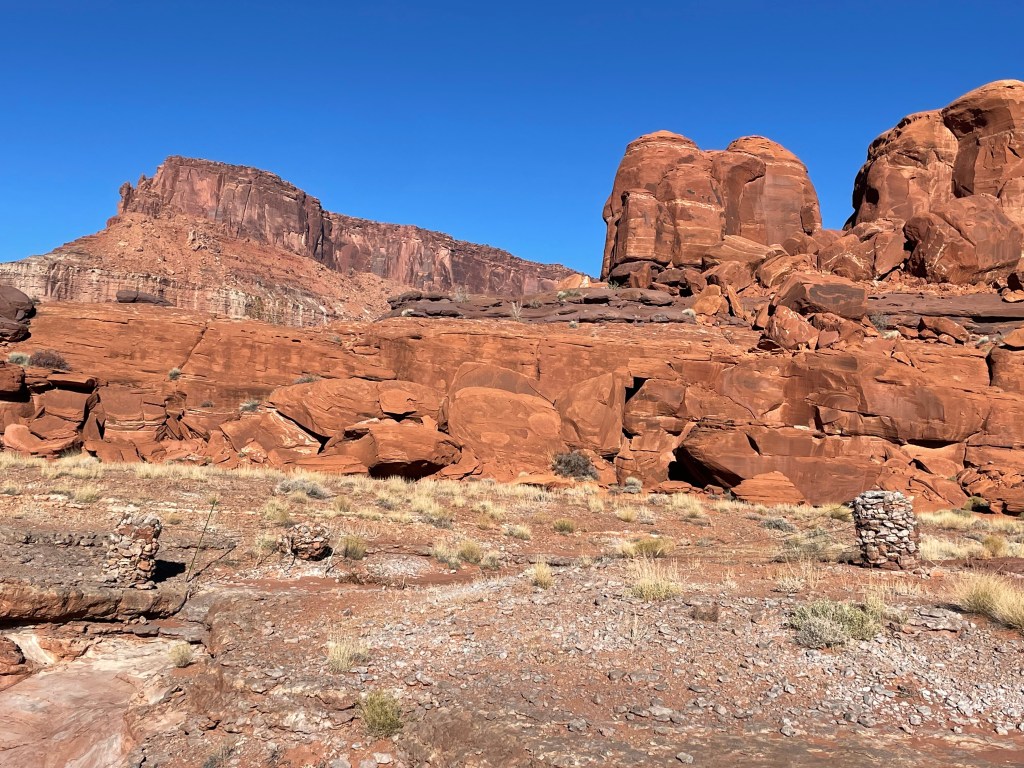
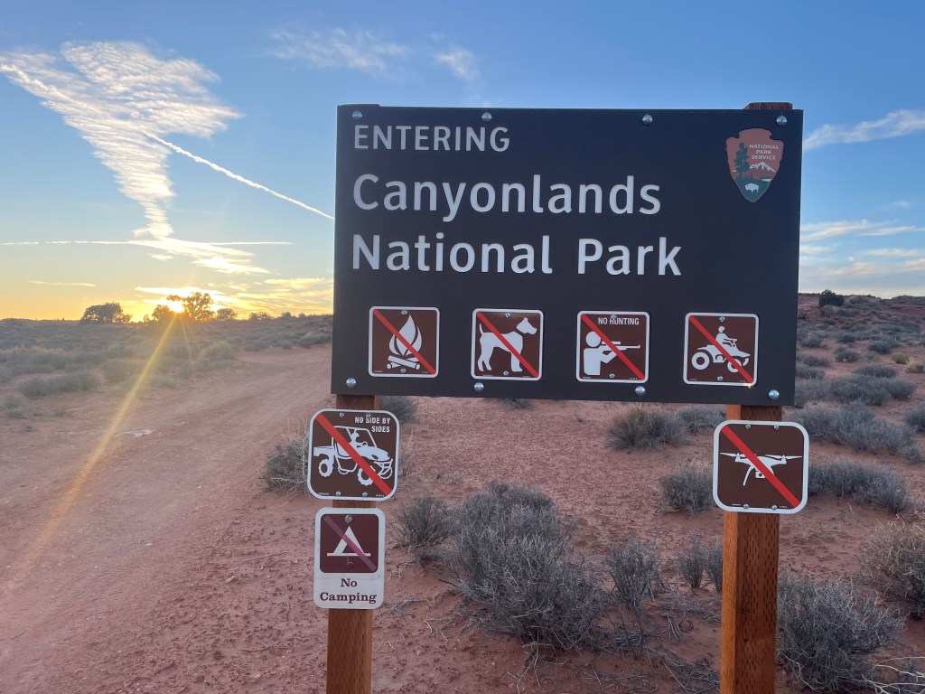
Once on top of the ledges, we found impressive walls of rock sitting on top of the shelves. The guidebook describes three pyramid shaped rocks (we decided one looks more like a battleship than a pyramid) to contour around. Once out of the rock ledges, the pyramids were easy enough to find on the horizon. I only took us on one minor wild-goose chase, climbing up slightly too high elevation wise. We crossed in and out of Canyonlands a couple times throughout the afternoon, but weren’t officially in the park yet.


Once around the third pyramid, we scrambled down another drainage, named “we hope so wash” by the route creators. After a couple miles down one more canyon, we climbed out to a dirt road taking us into Canyonlands. The road crosses out of the park boundary, where we found a couple tent sized spaces without soil crusts to set up camp. Colin finally decided to set up his tent after frigid temperatures the night before.


After one more freezing night, we reached the final morning with about six miles to go. We hiked down to the road to salt creek and turned up a short drainage. After another brief cross country hike, we dropped into one more drainage to the bottom of Little Spring Canyon. We ended up a little to high in the canyon and on the wrong side. A quick scramble down got us back on track. At the very end we found one more pour-off to climb up. It seemed climbable enough with out packs and we used webbing to haul our packs to the top.

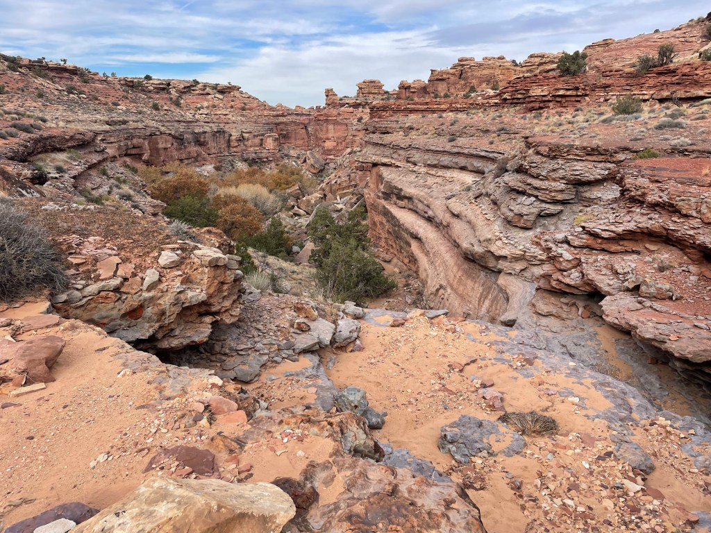
The drainage comes out at the park road in the Needles District of Canyonlands. A half mile walk down the road brought us to the Big Spring Overlook Trailhead and my truck.

From here the route continues on into Canyonlands, but that section will be for another time.
Reaching the end of our hike, we both looked forward to an actual meal and no longer sleeping in the cold. A five hour drive concluded our trip and we arrived in Flagstaff later that evening.
This section was absolutely beautiful and shows off Utah’s impressive and rugged country. The fall colors were definitely an added bonus, despite cold nighttime temperatures. Utah is really growing on me and route finding is just too much fun. Canyonlands might become a backpacking project in itself; so many canyons to see, so little time!
This will probably be the only Hayduke section for the winter, but I also wouldn’t put it past myself to try and sneak in one more short section before work starts again. Until then I’ll just be daydreaming about Utah and getting back to the Hayduke!


Great job Elizabeth! So proud of you!
LikeLiked by 1 person